

Within the Broadland Rivers Catchment, a number of organisations are involved in river and lake restoration and improvement works, including statutory bodies, local authorities, environmental organisations, landowners and community groups.
RiverLands
RiverLands aims to improve the quality of the water and wetlands, reduce flood risk to people and property and enhance biodiversity across the Upper Bure Valley above Aylsham. RiverLands is a national partnership programme between the National Trust and the Environment Agency (and Cyfoeth Naturiol Cymru – Natural Resources Wales) following the Catchment Based Approach.
The overall aim of the partnership is to work more strategically together in catchments where the National Trust has greatest land ownership to achieve multiple benefits for water, people and wildlife. In the upper Bure Valley this includes the Blickling and Felbrigg estates. For more information on the project visit the National Trust website.
Broads Authority
The Broads Authority are responsible for the integrated care of water and land, including conserving and enhancing Broads wildlife and award-winning work in managing navigation channels.
The Broads Peat Partnership (BPP) is working to restore degraded peatlands across the Broads National Park, including its river valleys and surrounding wetlands. Through raising water tables and restoring natural hydrology, we aim to turn damaged peatlands back into thriving, climate-resilient ecosystems – benefiting nature, heritage, water quality, and local communities. This work supports the government’s climate and environment commitments and their focus on restoring extensive areas of the UK’s damaged peatlands.
Natural England
Natural England are partners in many biodiversity projects within the Broadland Rivers Catchment, including the Hoveton Great Broad Project.
For many years, Hoveton Great Broad has been a mucky brown colour due to poor-quality polluted water entering it from the River Bure. Without clear water, plants cannot thrive and without the plants, the lake cannot support the wonderful variety of fish, birds and insects which it used to.
Thanks to better sewage treatment and improvements in farming practices over the last thirty years, river water quality has greatly improved and the time is now right to restore the broad to its former glory. This £4.5 million lake restoration project is one of the most ambitious of its type undertaken in the country. Taking the lessons of previous projects in the broads and applying novel techniques (such as biomanipulation) and cutting-edge technology, the aim is to transform 37 hectares of lifeless lake into an idyllic aquatic haven for wildlife.
Environment Agency
To manage flood risk the Environment Agency carries out maintenance, improvement or construction work on Main Rivers which are usually larger rivers and streams, other rivers are called ‘ordinary watercourses’. The Environment Agency has powers to carry out flood defence work apply to main rivers only. Lead local flood authorities, district councils and internal drainage boards carry out flood risk management work on ordinary watercourses.
The Environment Agency decides which watercourses are main rivers. It consults with other risk management authorities and the public before making these decisions. Some Environment Agency projects can be seen on our project map.
The Trinity Broads
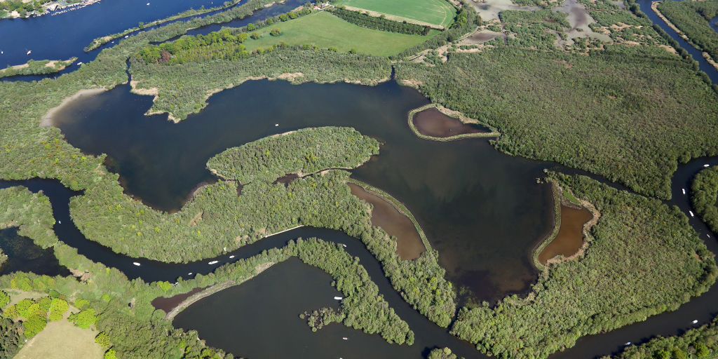
These broads are a tranquil and beautiful part of the Broads landscape, a hidden gem isolated from the main river system.
The Trinity Broads Partnership works to safeguard and enhance the Trinity Broads for wildlife and people. The Partnership includes Essex & Suffolk Water, Norfolk Wildlife Trust and the Broads Authority, who have been working together with local organisations and individuals for more than 15 years to restore the habitats to their full potential, and to encourage sustainable enjoyment of the site by the local community and visitors. Situated north-west of Great Yarmouth, the Trinity Broads make up 14% of the open water within the Broads. Habitats include wide expanses of shallow open water, extensive tracts of broadshore reedbed and undisturbed areas of wet woodland.
Situated north-west of Great Yarmouth, the Trinity Broads make up 14% of the open water within the Broads. Habitats include wide expanses of shallow open water, extensive tracts of broadshore reedbed and undisturbed areas of wet woodland.
Internal Drainage Boards
Internal Drainage Boards are responsible for management of water levels of ‘ordinary watercourses’ to reduce flood risk to agricultural land, properties and infrastructure in special areas including the Broads and Norfolk Rivers, which are both part of the Water Management Alliance (WMA); and Waveney, Lower Yare & Lothingland.
The WMA’s drainage and water level management infrastructure consists of a number of watercourses of varying sizes, which all discharge by gravity into main rivers, infrastructure can be viewed and downloaded online. Not all of the defences within the Drainage District are controlled by the WMA – the Environment Agency have operational responsibility for the Main Rivers and Coastal Defences. The WMA have permissive powers to manage the other infrastructure in their drainage district.
The WMA actively maintains only the most critical ordinary watercourses that are not main river, which equates to around 25% of the total length of ordinary watercourse in the drainage district. It is vitally important that these watercourses are regularly maintained to design levels, to properly convey flows to the main rivers.